The MODI project has achieved a significant milestone with the first trip and successful completion of data collection along the CCAM test corridor from Rotterdam to Oslo and back. This is a major step forward in assessing the corridor’s readiness for automated driving at SAE Level 4.
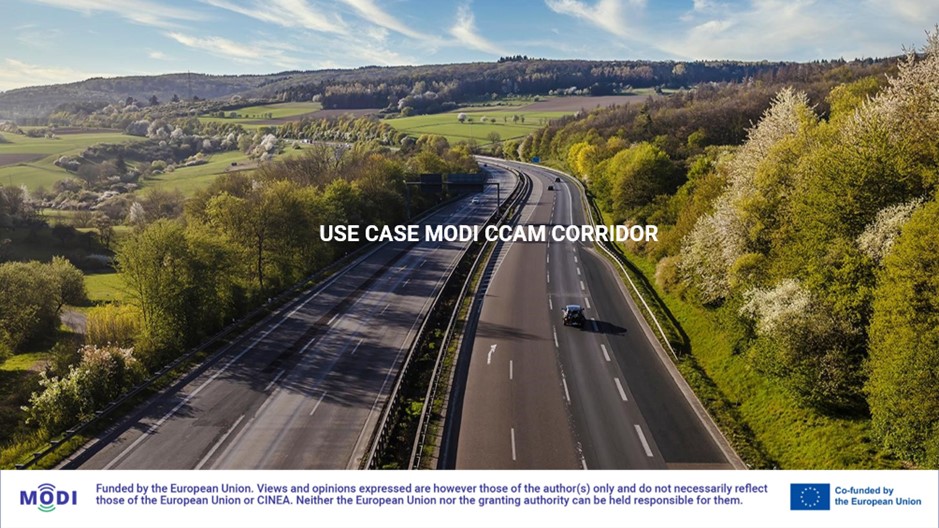
UC5: Assessing the Corridor for Level 4 Automation
UC5 (Use Case 5) of the MODI project focuses on evaluating the feasibility of SAE Level 4 automation along the entire Rotterdam-Oslo corridor. This involves extensive data collection targeting critical road segments and challenges that autonomous vehicles might encounter.
While no actual Level 4 driving takes place in UC5, the gathered data will be crucial for understanding the corridor’s readiness for this advanced technology.
Data Collection Underway
The data collection process began in March-April 2024 and is ongoing. Q-Free leads the initiative, with partners like VOLVO, Einride, DAF, DFDS, Federal Highway Research Institute (BASt), SINTEF and Gruber contributing to the driving and data acquisition and analysis.
Public Roads: Assessing Corridor Readiness for Level 4
This use case aims to assess the corridor’s readiness for Level 4 self-driving vehicles along the entire Rotterdam-Oslo stretch, in both directions. This assessment will involve:
- Identifying potential barriers related to both infrastructure (PDI) and vehicle technology that hinder Level 4 driving.
- Mapping the current infrastructure status and analyzing the data to evaluate the corridor’s preparedness for Level 4 automation.
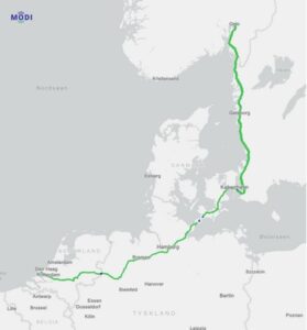
MODI corridor is part of the TEN-T network (map)
By pinpointing these challenges, the project can pave the way for the optimal implementation of automated logistics within international transportation.
The First Trip: A 3400 km Journey
The first trip along the corridor covered an impressive 3400 km each way, encompassing:
- Five countries
- One ferry crossing between Denmark and Germany
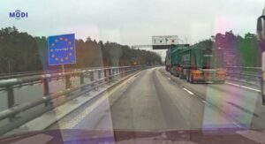
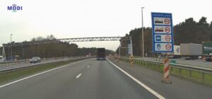
- One EU border with customs procedures (Sweden/Norway)
- Four Schengen borders
- Four days of travel
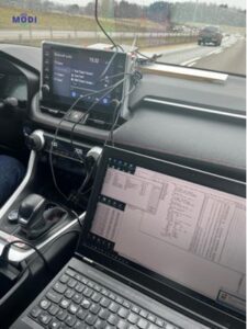
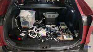
Equipment Used for Data Collection
A comprehensive set of equipment was used to gather data during the trip, including:
- A reference GNSS for positioning with high accuracy (less than 1 meter)
- Standalone GNSS receivers with L1 and L5 capabilities.
- Smartphones with 5G and LTE (4G) capabilities
- LTE CAT-M1 modems for IoT performance testing
- Dashcam for forward-facing video recording
- Accelerometer for measuring acceleration (bumpy road)
- V2X ITS G5 devices for communication between vehicles and infrastructure
- Onboard personnel: one driver and one computer operator
The data collection resulted in a significant amount of information, with over 600 GB collected.
Initial Observations: Highlighting Key Points
The first trip provided valuable insights into the current state of the Rotterdam-Oslo corridor. Here are some key observations:
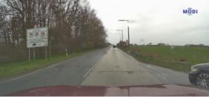
- Detours and Roadworks: A significant detour north of Gothenburg due to a mudslide and numerous roadwork sections, especially in Germany and the Netherlands (the longest being 30 km).
- Merging Differences: Variations in motorway entrance procedures across countries. Norway uses a right lane merge with an acceleration lane, while Denmark, Germany, and the Netherlands use an acceleration lane with yield signs (sometimes very short).
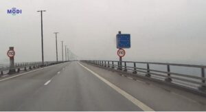
- Speed Limit Variations: Speed limits differed between countries, ranging from 80 km/h (unlimited in some sections) in Germany to 110 km/h (maximum) in Norway.
- Shoulder Usage: Variations in shoulder availability and usage. Some sections have very narrow shoulders, while the Netherlands employ dynamic shoulder use as a regular driving lane.
- Road Markings: Overall good quality, but color usage and lane markings varied between countries. Germany uses yellow markings for temporary roadworks, and the Netherlands employs dynamic shoulder use, which can cause confusion with lane markings.
- Mobile Network Connectivity at Borders: Initial data suggests a potential loss of mobile network connectivity when crossing the German-Netherlands border, similar to observations at the Svinesund border in previous MODI studies by Lykkja, O.M., and Arnesen, P., published in the Transport Research Procedia for the TRA Dublin 2024 Conference (Lykkja & Arnesen, 2024). Further investigation is required.
For detailed view of the MODI route click here
Work in Progress: Stay Tuned for Updates
The final data collection and assessment of UC5 is expected in 2025. The MODI project remains committed to keeping you informed throughout the data collection phase. Stay tuned for further updates on this exciting initiative!
Want to meet us at other events? Join our Newsletter, and Keep following MODI on LinkedIn and X (Twitter) to be updated with its latest developments.